
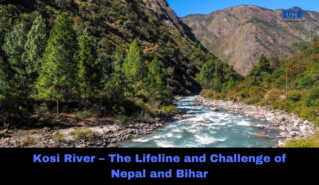
The Kosi River is one of the major rivers in the Indian subcontinent. It flows through China, Nepal, and India, playing a crucial role in the geography, economy, and lives of millions of people. However, it is also known as the “Sorrow of Bihar” due to its frequent flooding, which causes destruction in the region.
This article covers the origin, geography, tributaries, significance, and flood impact of the Kosi River in simple language.
Introduction to Kosi River
The Kosi River, also spelled as Koshi, is a transboundary river that flows through three countries—China, Nepal, and India. It originates from the Himalayas and finally merges into the Ganges River in Bihar, India. The river is around 729 km (453 miles) long and has a basin area of 74,500 sq. km (28,800 sq. miles).
Kosi is a part of the Ganga River System and is the third-largest tributary of the Ganges in terms of water discharge, after Ghaghara and Yamuna Rivers.
Fast Facts About Kosi River
| Feature | Details |
|---|---|
| Countries | China, Nepal, India |
| States/Provinces | Tibet, Koshi Province (Nepal), Bihar (India) |
| Source | Saptakoshi (formed by Sun Kosi, Arun, and Tamur rivers) |
| Mouth | Ganges River, Bihar, India |
| Length | 729 km (453 mi) |
| Basin Area | 74,500 sq. km (28,800 sq. mi) |
| Major Cities Along the River | Saptari, Sunsari, Supaul, Katihar, Bhagalpur |
Origin and Tributaries of Kosi River
Origin of Kosi River
The Kosi River is formed by seven tributaries in Nepal, earning it the name Sapta Kosi (meaning “Seven Kosi Rivers”). The main tributaries include:
- Tamur River – Originates near Kangchenjunga, the world’s third-highest peak.
- Arun River – Flows from Tibet and covers the largest drainage area.
- Sun Kosi River – Formed by multiple smaller rivers.
Other tributaries of Sun Kosi include:
- Dudh Kosi
- Likhu Khola
- Tamakoshi River
- Bhote Koshi
- Indravati River
These tributaries merge at Triveni (Nepal) to form the Sapta Kosi, which enters Bihar, India, and flows into the Ganges River near Kursela (Katihar district).
Major Tributaries in India
In Bihar, the Kosi River receives additional tributaries like:
- Kamala River
- Bagmati River
- Bhutahi Balan River
Geography and Course of Kosi River
The Kosi River Basin covers six geographical regions with altitudes ranging from 8,000 meters (26,000 ft) in the Himalayas to 95 meters (312 ft) in the plains. These regions are:
- Tibetan Plateau
- Himalayas
- Himalayan Mid-Hills
- Mahabharat Range
- Siwalik Hills
- Terai Plains
The river enters India through the Chatra Gorge in Nepal and creates a huge alluvial fan (15,000 sq. km) in Bihar.
To Know More About Famous People of Uttarakhand
Importance of Kosi River
Irrigation and Agriculture
- The Kosi River supports millions of farmers in Nepal and Bihar.
- Provides irrigation to vast agricultural lands.
Hydropower and Energy
- The Kosi Barrage supplies hydroelectric power.
- Nepal and India have future hydropower projects planned.
Biodiversity
- Home to rare aquatic species like the Gangetic dolphin.
- Supports diverse fisheries and local livelihoods.
Kosi River Floods – The “Sorrow of Bihar”
The Kosi River is unpredictable and has changed its course multiple times, leading to severe flooding.
Why Does Kosi Flood?
- The river carries a lot of silt, which raises the riverbed.
- Heavy monsoon rains increase water volume.
- The river changes its course suddenly, breaking embankments.
Major Floods in Kosi River
| Year | Flood Impact |
|---|---|
| 1954 | Severe floods led to the Kosi Barrage construction. |
| 2008 | A breach at Kusaha (Nepal) displaced 2.7 million people. |
| 2024 | Recent floods caused severe destruction in Bihar and Nepal. |
Measures to Control Floods
- Kosi Barrage at Bhimnagar, Nepal.
- Embankments and drainage systems in Bihar.
- Proposed Kosi High Dam Project in Nepal.
Kosi Barrage and River Management
The Kosi Barrage was built in 1959 at Bhimnagar (Nepal) under the India-Nepal Agreement of 1954. It controls water flow and helps in irrigation and flood control.
However, due to excessive siltation, the barrage alone is not enough to prevent floods. There is an urgent need for a high dam project in Nepal to provide a permanent solution.
Frequently Asked Questions (FAQs)
Q1: Why is the Kosi River called the “Sorrow of Bihar”?
The Kosi River frequently changes its course and causes flooding in Bihar, destroying homes and farmlands.
Q2: Where does the Kosi River originate?
The Kosi River originates in Nepal from the Saptakoshi tributaries, which include Tamur, Arun, and Sun Kosi rivers.
Q3: What is the length of the Kosi River?
The total length of the Kosi River is 729 km (453 miles).
Q4: Which states and countries does the Kosi River flow through?
The river flows through Tibet (China), Nepal, and Bihar (India) before joining the Ganges River.
Q5: How do floods affect Bihar?
Floods cause massive displacement, loss of life, and damage to agriculture every year in Bihar.
Q6: What is the Kosi Barrage?
The Kosi Barrage at Bhimnagar, Nepal, is a dam that controls the flow of the Kosi River to prevent flooding and provide irrigation.
Q7: What are the major cities along the Kosi River?
Important cities along the river include Saptari, Sunsari, Supaul, Katihar, and Bhagalpur.
The Kosi River is a lifeline for millions but also a source of destruction due to its flooding nature. With better flood control measures, embankments, and proper river management, the devastating floods can be minimized, and the river’s potential can be utilized for irrigation, hydroelectricity, and fisheries.
For a sustainable future, both India and Nepal must work together to find long-term solutions for managing the Kosi River effectively.
If you liked this post related to films, then please share it on Facebook | Twitter | Instagram or | Youtube