
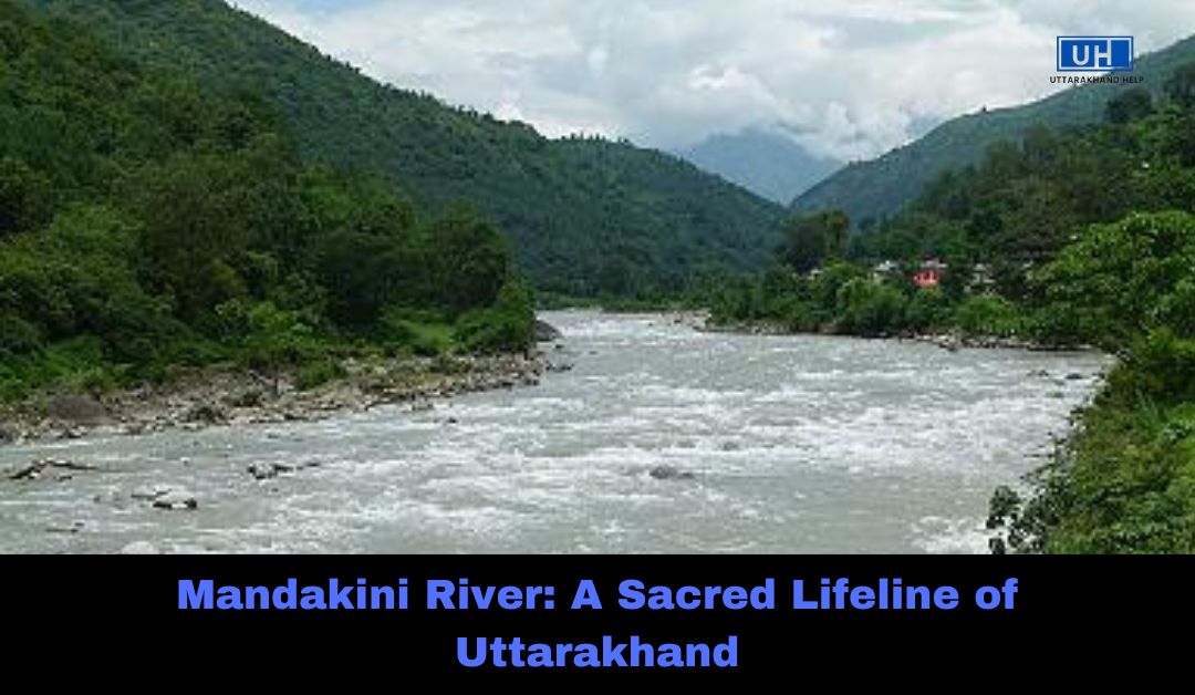
The Mandakini River is a sacred river flowing through the Indian state of Uttarakhand. It is an important tributary of the Alaknanda River, which ultimately joins the Ganges. The river originates from the Chorabari Glacier near Kedarnath and travels approximately 81 kilometers before merging with the Alaknanda at Rudraprayag.
Apart from its spiritual significance, Mandakini is also known for its picturesque landscapes, attracting millions of pilgrims and tourists every year. However, it is also prone to natural disasters, such as the devastating 2013 Kedarnath flash floods. This article explores the history, geography, significance, and environmental concerns surrounding the Mandakini River.
Geographical Features of Mandakini River
1. Source and Course
- The Mandakini River originates from the Chorabari Glacier, located near the Kedarnath Summit at an elevation of 3,895 meters (12,779 feet).
- It flows through the Kedarnath Valley, passing Sonprayag, Ukhimath, and Guptkashi before joining the Alaknanda River at Rudraprayag.
- The river covers a total distance of 81.3 kilometers (50.5 miles).
- Along its course, Mandakini merges with several small streams, including the Songanga River at Sonprayag.
2. Climate and Rainfall
- The Mandakini River region experiences cold temperatures due to its high altitude.
- Summers are mild, with maximum temperatures reaching 30°C (86°F), while winters can be extremely cold, sometimes dropping below freezing point.
- The region receives heavy rainfall, especially during the monsoon season (July–October), with annual rainfall ranging from 1,000–2,000 mm (39–79 inches).
To Know More About Famous People of Uttarakhand
Spiritual and Religious Importance
1. Sacred River in Hinduism
- In Hindu mythology, the Mandakini River is highly revered. The name ‘Mandakini’ means ‘celestial river’ and is often associated with the Ganges of Heaven.
- It is mentioned in ancient Hindu texts like the Puranas, which describe it as a divine river flowing from the heavens to the Earth.
2. Temples Along the Mandakini River
- The river passes through important pilgrimage sites, including:
- Kedarnath Temple – One of the 12 Jyotirlingas and a part of the Char Dham Yatra.
- Madhyamaheshwar Temple – Another important Shiva temple in the region.
- Tungnath Temple – The highest Shiva temple in the world.
- Devotees believe that bathing in the river washes away sins and brings spiritual purity.
3. Role in Pilgrimage Tourism
- The Kedarnath trek, which follows the Mandakini River, attracts millions of pilgrims every year.
- Pilgrims also visit Deoria Tal, a scenic lake near the river, known for its reflection of the Himalayan peaks.
- The river also supports local businesses that cater to pilgrims through lodges, food stalls, and travel services.
Mandakini River in Southern Uttar Pradesh and Madhya Pradesh
Interestingly, there is another Mandakini River in Chitrakoot, Madhya Pradesh, which flows northward and is a tributary of the Yamuna River. This river plays a crucial role in the economy and culture of the region, as it supports agriculture, trade, and local settlements.
- The river is known as Payasuni in some texts and is considered holy in Hinduism.
- Many natural springs contribute to this river, especially near Sati Anusuiya.
- It supports the farming industry, providing fertile soil due to regular flooding.
Environmental Concerns and Challenges
1. Impact of Climate Change
- Rising temperatures are causing the Chorabari Glacier to melt, increasing the risk of floods and landslides.
- Scientists have recorded a reduction in the glacier’s size, which affects the river’s water flow.
2. 2013 Kedarnath Flash Floods
- On June 16–17, 2013, heavy rainfall and a glacial lake outburst flood (GLOF) led to the worst disaster in the Mandakini River’s history.
- A part of Chorabari Lake collapsed, triggering massive floods and landslides.
- Villages like Kedarnath, Rambara, and Gaurikund were completely destroyed.
- Over 5,700 people lost their lives, including pilgrims, locals, and tourists.
- The Kedarnath Temple miraculously survived, although the surrounding areas were severely damaged.
3. Deforestation and Soil Erosion
- Uncontrolled tourism and urbanization have led to deforestation, which increases soil erosion and affects the river’s health.
- Frequent landslides and flash floods have resulted in loss of vegetation and fertile land.
4. Pollution and Waste Management
- With millions of tourists visiting the river, the amount of plastic waste, sewage, and industrial pollutants has increased.
- There is a need for stricter environmental regulations to preserve the natural beauty and purity of the river.
Conservation Efforts
1. Kedarnath Wildlife Sanctuary
- To protect the fragile ecosystem, the Kedarnath Wildlife Sanctuary was established.
- This sanctuary is home to rare Himalayan flora and fauna, including musk deer, snow leopards, and Himalayan monals (state bird of Uttarakhand).
2. Afforestation Projects
- The government has started tree-planting programs to prevent landslides and restore forest cover.
3. Sustainable Tourism Initiatives
- The Uttarakhand government is promoting eco-tourism and waste management programs to reduce environmental damage caused by visitors.
Frequently Asked Questions (FAQs)
Q1. Where does the Mandakini River originate?
The Mandakini River originates from the Chorabari Glacier, near Kedarnath, at an elevation of 3,895 meters (12,779 feet).
Q2. Why is the Mandakini River considered sacred?
The Mandakini River is closely associated with Hindu mythology and flows through important pilgrimage sites like Kedarnath and Madhyamaheshwar temples.
Q3. What caused the 2013 Kedarnath floods?
The 2013 Kedarnath floods were caused by heavy rainfall, glacial lake outburst flooding (GLOF), and landslides, leading to massive destruction and loss of life.
Q4. How long is the Mandakini River?
The Mandakini River flows for approximately 81.3 kilometers (50.5 miles) before joining the Alaknanda River.
Q5. What are the major conservation efforts for the Mandakini River?
Key conservation efforts include:
- Kedarnath Wildlife Sanctuary for biodiversity protection.
- Afforestation projects to reduce soil erosion.
- Sustainable tourism initiatives to minimize pollution.
The Mandakini River is not just a lifeline for Uttarakhand, but also a spiritual and cultural icon. However, due to climate change, deforestation, and pollution, the river’s future is under threat. By promoting sustainable tourism and conservation efforts, we can ensure that the Mandakini continues to flow for generations to come.
If you liked this post related to films, then please share it on Facebook | Twitter | Instagram or | Youtube